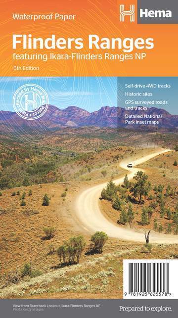
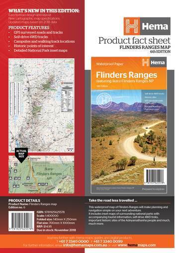
Hema Map Flinders Ranges 6th Edition - Featuring Ikara-Flinders Ranges NP
SKU code: 9321438001607
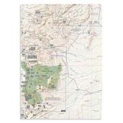
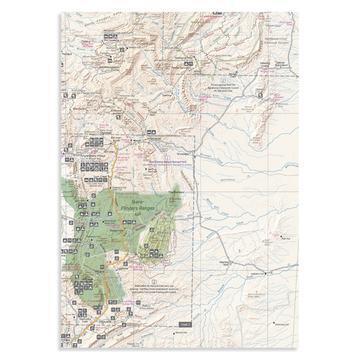
Flinders Ranges Map (6th edition)
This waterproof map of South Australia's Flinders Ranges includes inset national park maps and visitor information on the spectacular Flinders Ranges and Vulkathunha-Gammon Ranges, including information on the history and traditions of the Adnyamathanha people — making trip planning and navigation simple. Accompanying tourist information includes self-drive 4WD treks, historic sites and contact details listed for national parks and reserves.
KEY FEATURES
• GPS surveyed roads and tracks
• Self-drive 4WD tracks
• Camping, bush camping, walking tracks
• Historic sites
• Detailed National Park inset maps
KEY SPECIFICATIONS
Edition: 6th
Publication Date: 1/11/18
Scale: 1:400,000
Folded size (WxHxD): 140mm x 250mm x 3mm
Flat size (WxH): 700mm x 1000mm
Weight: 0.09kgs
Product Features
• GPS surveyed roads and tracks
• Self-drive 4WD tracks
• Camping, bush camping, walking tracks
• Historic sites
• Detailed National Park inset maps What's New in This Edition
• New edition, new layout
• New cartographic map specifications
• All maps updated, based on our latest 2018 field trip
• All inset maps are now provided in a better scale
| SKU | 9321438001607 |
| Model # | 9781925625578 |
| Barcode # | 9321438001607 |
| Brand | Hema Maps |
| Shipping Weight | 0.1000kg |
| Shipping Width | 0.200m |
| Shipping Height | 0.010m |
| Shipping Length | 0.300m |
| Shipping Cubic | 0.000600000m3 |
Be The First To Review This Product!
Help other Down Under Camping users shop smarter by writing reviews for products you have purchased.


